

View Programme
Rural Rambles Page
Rural Rambles Booklet

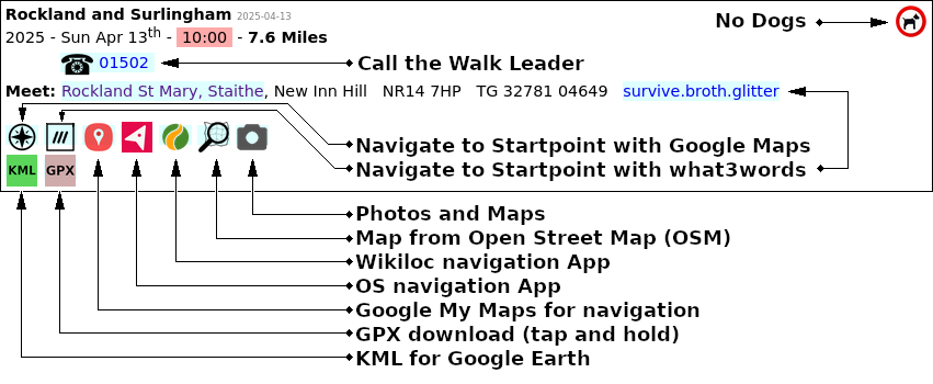
These three apps are extremely useful when navigating on walks.


Almost all of our walks have recorded GPX and KML files.
The GPX files can be imported into many walk sharing apps. For example the OS App, Outdoor Active, BikeGPX and Wikiloc.
These apps allow you to follow a route on your smartphone.
If you have a handheld GPS device, many will accept GPX files and you can navigate without needing a mobile phone signal.
The KML files are useful for viewing walks using Google Earth.
Several prospective walk leaders have said that having an experienced walk leader accompany them when they carry out their first recce would be helpful. If you are thinking about becoming a walk leader and would like a 'walk buddy' to help plan your first walk, please phone one of the existing walk leaders to arrange a date - their numbers are on the programme. You could accompany them on a recce of a walk they are planning, or they accompany you on one you have in mind. You could also ask for assistance using our FaceBook page.
But please do consider volunteering to lead a walk. Our existing walk leaders are willing to help new leaders, and online training is available. Please click for more safety details.
Ramblers published new Risk Assessment guidance. More details here ...
Safety on Walks - Risk Assessments

Please mail Neil for website updates.
Waveney Ramblers is a part of The Ramblers' Association.
Copyright © 2026 Waveney Ramblers.
This website does not use biscuits.